A bench above Thirty-seven Mile Creek
Sixty-five hectares of forested Crown land on a bench west of Whitehorse, 262 metres from Thirty-seven Mile Creek and 475 metres from the end of the Kluane Wagon Trail. Most of it faces south or west. This file shows the ground in three dimensions, what the valley looked like in 1946 and 1949, and a site designer for planning the farm before the application is written.
- Area
- 65.0 ha (160.7 acres), 902 × 721 m
- Centre
- 60°53′03″ N, 135°49′04″ W
- Elevation
- 722–802 m; median slope 5.4°
- Access
- Kluane Wagon Trail, 475 m (GeoYukon road network)
- Water
- Thirty-seven Mile Creek, 262 m
- Territory
- Champagne and Aishihik First Nations and Kwanlin Dün First Nation traditional territories
- Screen
- No conflict on checked layers · 4 review flags below
The parcel shares its south-west boundary area with CAFN Settlement Land (Lot 1035, 13 m away). The application asks you to name the traditional territories and engage the First Nations before you apply.
The CAFN heritage route The Selkirk Trail passes 168 m from the parcel. A heritage assessment is required before the environmental review.
No field soil survey covers the parcel. The nearest assessed ground, 123 m away, is mapped Class 5 and Class 6. Title needs at least 80% of the parcel to be Class 5 or better.
Two broad Wildlife Reserve notations (80 km² and 19,500 km²) cover the area, and the parcel is inside the Greater Whitehorse development area. Both need a call to Lands Branch.
Checked on 26 Sep 2026 against GeoYukon land tenure (surveyed and titled parcels, dispositions, applications, notations, holds), First Nation Settlement Land, parks, fire history and land-planning layers. A clear result means no conflict was found in those layers on that date. It is not a legal determination of availability.
The valley on the 1949 map
This is the first-edition topographic sheet for Whitehorse, cut to a 16 km square around the parcel and laid flat.
NTS 105 D, 1:250,000, first edition 1949. Georeferenced from 28 printed UTM grid intersections (RMS 1.6 px, about 34 m).
The same sheet on the ground
Draped on ArcticDEM elevation, the brown 500-foot contours line up with the real hills. Vertical scale is doubled so the bench reads.
ArcticDEM v4.1 10 m mosaic, averaged to 20 m. Polar Geospatial Center.
Roads and rivers
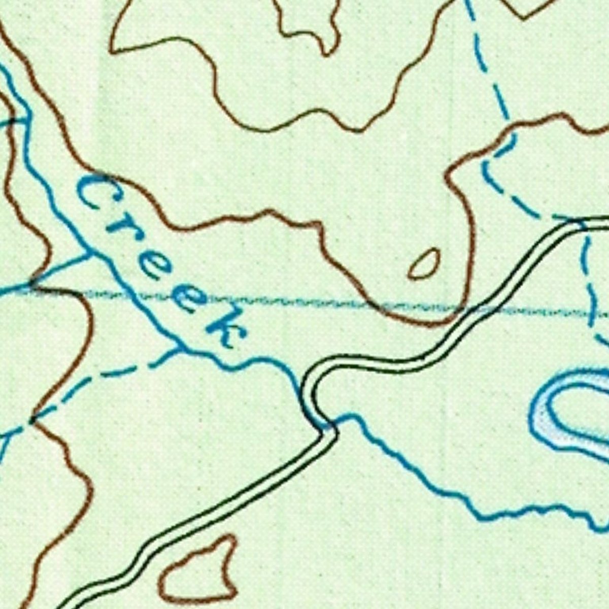
The Alaska Highway was built through this valley in 1942. The double line running north-east is marked "Dawson Road" on this sheet. The creek below the bench is labelled Stony Creek in 1949; today's gazetteer names the stream in that valley Thirty-seven Mile Creek.
The valley now
The Government of Yukon's satellite composite shows the same 16 km today, with the forest that grew back after the 1958 fire.
Yukon Composite 150 cm (SPOT-6/7), Government of Yukon imagery service.
The candidate parcel
The red outline is the 65-hectare candidate. It sits on a bench between two creeks that have cut down into the valley fill.
The valley's record, 1887 to 1958
Every entry below comes from a source you can open. The parcel lies within the traditional territories of the Champagne and Aishihik First Nations and the Kwanlin Dün First Nation.
- Before 1880
Nakhu chu
The Southern Tutchone name for the Takhini River is Nakhu chu, "crossing with a raft". "Takhini" comes from a Tlingit word meaning king salmon. Coastal Tlingit traders followed the river to a salmon camp at the mouth of the Little River to trade with the Ta'an Kwäch'än and Champagne and Aishihik people.
- 1887
Dawson's reconnaissance
George M. Dawson of the Geological Survey of Canada mapped the "Tahk-heena River", noting at its mouth a river 237 feet wide running two miles an hour.
- 1903
Steamboats to the Kluane goldfields
After Dawson Charlie (Káa Goox) staked the discovery claim on Fourth of July Creek, White Pass & Yukon Route sternwheelers ran up the Takhini to Steamboat Landing at the mouth of the Mendenhall River.
- 1904
The Kluane Wagon Road
A wagon road was built west through the Takhini–Dezadeash valley to the goldfields. The nearest mapped road to the parcel today carries the name Kluane Wagon Trail in the territory's road network.
Yukon History Trails · GeoYukon Yukon Road Network
- 1942
The Alaska Highway
The US Army built a temporary bridge over the Takhini, using the old trail and wagon road until the highway bridge was finished.
- 1946
The RCAF photographs the bench
Photo A10562-120 was taken on 24 August 1946 at 1:25,000. It shows a closed conifer forest on the bench. You can lay it over the terrain in Plate III.
National Air Photo Library, record 857673; scan via the Government of Yukon air photo inventory.
- 1958
Fire number 61
A 90,049-hectare fire burned across the whole parcel. The valley's white spruce was largely lost, and most of it has grown back as trembling aspen and willow.
GeoYukon Fire History, FIRE_ID 195800061 · Sights and Sites: Takhini Valley
The CAFN heritage route recorded in GeoYukon as The Selkirk Trail (Kusawa Lake to the Takhini River, Klusha Creek, the Nordenskiold and Yukon rivers and Fort Selkirk) passes 168 m from the parcel.
The 160 acres
This is the parcel and the ground around it: 2 km square on a 2 m grid. You can drag to turn the model.
ArcticDEM v4.1 2 m, shifted to CGVD2013 heights. No LiDAR covers this parcel yet, so the bare-earth surface is estimated from the surface model.
August 1946
Twelve years before the fire, the bench was closed conifer forest. The white banks along both creeks are the same cut slopes you see today.
RCAF A10562-120, 1:25,000, orthorectified onto the terrain by Sprucestead. Alignment is within about 10–20 m.
After fire number 61
Across the valley, the forest that grew back after 1958 is mostly trembling aspen and willow. What stands on this bench now sets how much clearing there is and what timber has to be salvaged.
Agreements for Sale require merchantable timber to be salvaged.
The plan
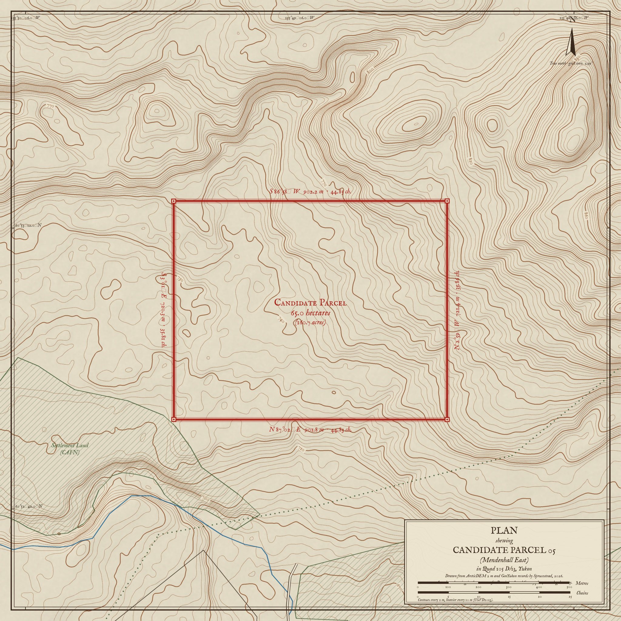
The same ground drawn as a survey plan: contours every 2 m, the parcel boundary with bearings and distances in metres and chains, and the neighbouring Settlement Land and titled lot.
A modern drawing in the manner of a Dominion Land Survey plan. It is not a legal survey.
Slope
57% of the parcel is under 6°, which is easy to cultivate. Most of the steeper ground, 9° and over, is in the eastern half.
Summer sun
Clear-sky sunshine from 19 May to 13 September on each 4 m cell, compared with flat ground. South-facing ground gets up to 7% more and the shaded hollows about 4% less. That matters most for a greenhouse and berries.
Where cold air settles
On still nights cold air drains downhill and pools in hollows. Darker blue marks ground that is lower than its surroundings, where frost comes first. Keep frost-tender crops on the lighter ground.
Air-drainage rule from the Yukon Garden Handbook (1987), applied to the terrain.
Slope, sun, cold air and water
Four measurements on a 4 m grid, computed from the terrain. The site designer uses them to check where each building and crop goes.
The Agreement for Sale gives up to seven years to clear, break, cultivate and seed at least 60% of a soil-based parcel. Ground used to store brush and stumps does not count.
Cultivating Our Future: 2020 Yukon Agriculture Policy, B-4 · Agriculture land development guidelines
Slope from the estimated bare-earth surface, smoothed over 6 m. A LiDAR survey would sharpen this.
Design the farm
An example plan is loaded so you can see how it works. Move, reshape or delete anything. Pick a tool on the left, then click the ground to place it. Fields, roads, fences and shelterbelts take several clicks; double-click or press Enter to finish. Every change is checked against the rules on the right.
The site designer needs WebGL, which this browser has turned off.
The site plan
Your design, drawn to scale with the items the Farm Development Plan asks for in Section 2A: buildings with dimensions, access, shelterbelts, field layout, fence lines and water sources. It updates as you edit.
The site plan draws when the designer has loaded.
Farm Development Plan form, Section 2A · Agricultural Land Application YG(3344EMR) Rev.02/2025
From application to title
The Land Package turns this file and your design into the documents the Agriculture Branch reviews. The government's own fee is $25 plus GST.
- Day 0
Apply
Form YG3344 with a location map at 1:30,000 or 1:50,000 and corner coordinates to the second.
- Within 10 days
Preliminary screen
The Branch confirms the site is available and accepts or rejects.
- Within 60 days
Farm Development Plan
Developments at least equal to the land value, with the site plan. Scored out of 1,360; 700 to pass.
- Then
Soil and heritage
Branch soil investigation and a heritage assessment.
- 14-day comment minimum
YESAB review
Governments, First Nations and the public comment. Yukon accepts, rejects or varies the result.
- Up to 7 years
Agreement for Sale
Survey, then develop: 60% cleared and seeded before title transfers.
Application answers
YG3344 filled from this file: location, access, adjacent uses, traditional territories, corner coordinates.
Location map
NTS reference, north arrow, scale, road kilometre, access, nearby water.
Site plan
The drawing above, with a schedule of buildings, fields, fences and water.
Development schedule
Year-by-year clearing and building plan that reaches 60% before the Agreement ends.
Evidence ledger
Every layer checked, with source, date and result, and the list of items to confirm with the Branch.
Stages from the application form (Rev.02/2025, p.1) and yukon.ca/en/apply-agriculture-land. YESAB comment periods from yesab.ca. FDP scoring from the Farm Development Plan form.