Find the land. Plan the farm. File the application.
We screen Yukon Crown land for farming, build a 3D land file for each of your three best candidates, let you lay out the farm on the real terrain, and turn that plan into your agricultural land application and Farm Development Plan.
From a brief to a filed application
- 1
Brief
Tell us what you want to grow or raise, how much land you need and which parts of the territory you would consider.
You send: a 15-minute intake - 2
Screen
We check Crown land across the territory against titled and surveyed parcels, dispositions, Settlement Land, parks, holds and applications, then score what is left for soil, sun, frost, water and access.
We send: three candidates - 3
Land files
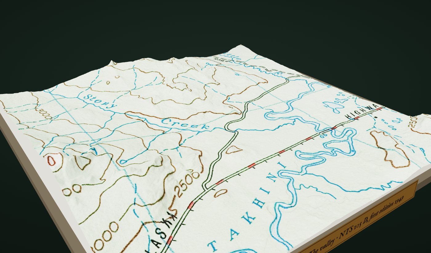
Each candidate gets a 3D land file: 2 m terrain, the 1946 air photo, the 1949 map, today's imagery, and slope, sun and cold-air maps.
You choose: one parcel - 4
Design
Lay out the house, barn, greenhouse, well, septic, fields and access road on the terrain. Each change is checked against setbacks, slope limits and the 60% clearing rule.
You approve: the site plan - 5
Apply
We prepare form YG3344, the location map, the Farm Development Plan with your site plan, and an evidence ledger of every check we ran.
You sign: the application
See the ground before you drive to it
The sample is candidate 05, 65 hectares above Thirty-seven Mile Creek west of Whitehorse. Scroll through the valley on the 1949 map, compare the 1946 photograph with today, then plan a farm on it.
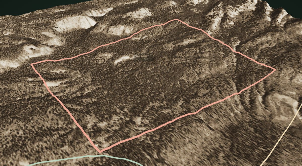
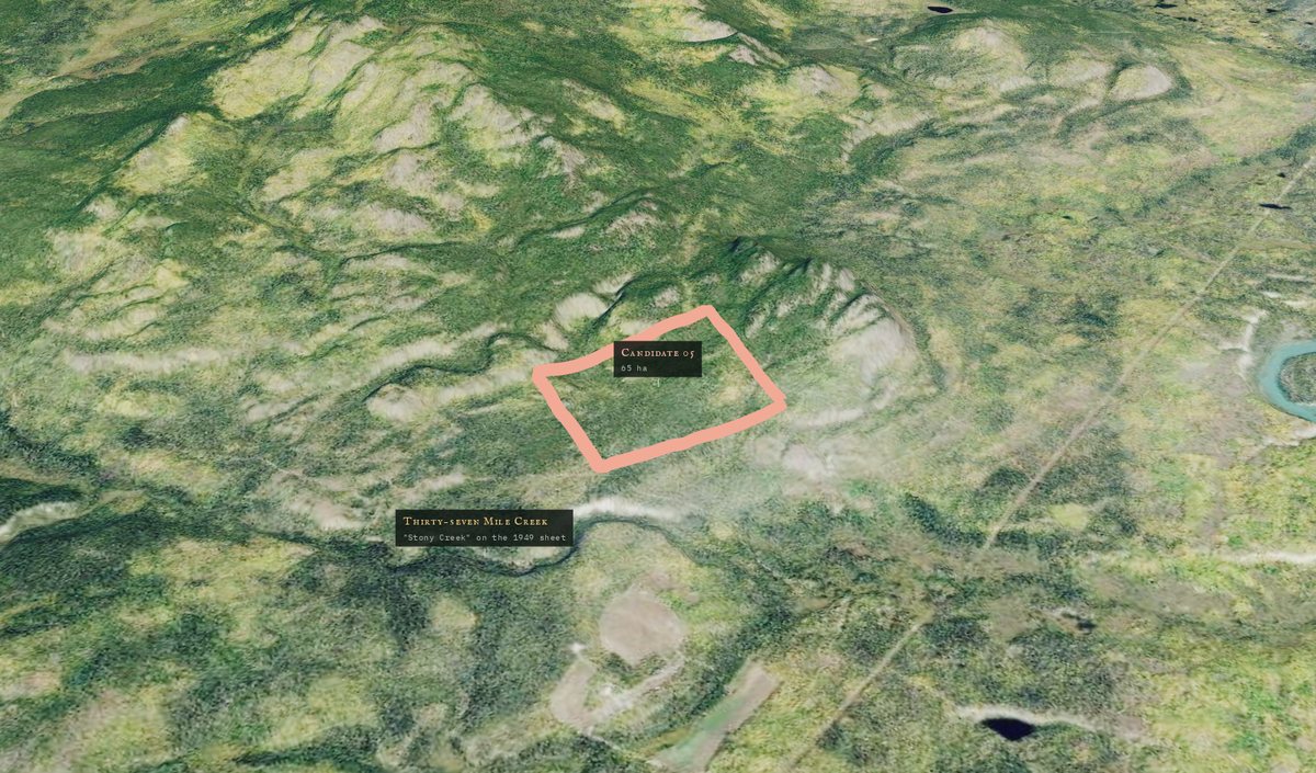
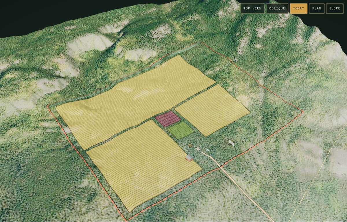
Every land file ends in a site plan drawn to scale, with the buildings, access, shelterbelts, field layout, fences and water sources the Farm Development Plan asks for.
What you receive
- Territory-wide screenCrown land checked against every tenure, Settlement Land, park, hold and application layer we list below, stamped with the query date.
- Three candidate parcelsScored for soil evidence, sun, frost, drainage, water and road access, with the inputs shown next to each score.
- Three 3D land filesTerrain at 1–2 m, historical air photos and maps, today's imagery and the slope, sun and cold-air layers.
- Your site planDesigned with you on the terrain, checked against setbacks and slope limits, drawn to scale for the Farm Development Plan.
- Completed YG3344 applicationWith the location map at 1:30,000 or 1:50,000, corner coordinates and the traditional territories the site lies in.
- Farm Development Plan draftA year-by-year schedule that reaches 60% cleared and seeded within the seven-year Agreement for Sale.
- Evidence ledgerEvery layer and rule checked, with source, date and result, and the items to confirm with the Agriculture and Lands branches.
- Submission supportWe walk the application through submission and answer the Branch's questions on the screen and site plan.
A screen, not a decision
Only the Government of Yukon decides whether land is available. A clear result from us means no conflict was found in the layers below on the date we checked them.
Hard conflicts
- Titled and surveyed land parcels, including titled agricultural lots
- Land dispositions, active applications and agricultural reservations
- First Nation Settlement Land
- Parks, protected areas and development holds
Review flags
- Notations such as wildlife reserves
- Neighbouring Settlement Land and recorded First Nation heritage routes
- Local area plans and development area regulations
- Distance from field-assessed soil capability mapping
What a screen cannot see
- Holds and applications not yet published
- Trapline and outfitting concession interests that need consultation
- Soil on unassessed ground, which only the Branch's site investigation confirms
Straight answers
Who owns the land you find?
The Government of Yukon. It is Crown land, and we never own, hold or broker it. If your application succeeds you sign an Agreement for Sale with the territory and earn title by completing the development in your Farm Development Plan.
What is the $25 fee, and what else will I pay the government?
The $25 plus GST is Yukon's application fee. If the application succeeds you also pay for the land and the legal survey. Development you complete under the Farm Development Plan offsets the land price dollar for dollar. We flag the expected amounts before you choose a parcel.
What does the Agreement for Sale require?
For soil-based parcels, at least 60% of the parcel cleared, broken and seeded to a crop before title, within up to seven years. The site designer tracks this as you plan.
How long does it take?
Our part takes about two to three weeks from intake to delivered package. The government's review includes a soil investigation, a heritage assessment and, for most applications, a YESAB review with public comment, so it can take many months.
Does a clean screen mean the land is available?
No. It means no conflict was found in the public layers we checked on that date. The evidence ledger lists what to confirm with the Branch before you rely on it.
Can consultants and surveyors use this?
Yes. Ask about multi-parcel pricing when you join the waitlist.
Join the waitlist
We are taking a small first group of Yukon applicants. Leave your email and we will reply with a start date, current turnaround and the intake form.
One reply when your group opens. We do not share your address.